
1st place, CuseHacks 2024
WalkSafe
A safety app for walking around Syracuse. It routes you around crime hotspots, shows your family on a live map, and tells them when you get home.
- Data
- 8,346 Syracuse police reports
- When
- March 2024
- Platform
- iOS and Android, built with Expo
- Stack
- React Native, Expo, Supabase, Flask, Pandas, Google Maps
- Problem
- Map apps find the fastest walk home. They don't know which blocks have the most reported crime.
- Solution
- A mobile app that scores 8,346 Syracuse police reports by severity and reroutes walks around the worst spots, with live family tracking on top.
- Result
- Won 1st place at CuseHacks 2024, Syracuse University's hackathon.
See it working
An 18-second walkthrough of the app.
The problem
Students walk around Syracuse at all hours, often alone. Google Maps will give them the shortest walk, but it has no idea which streets have the most reported crime, and nobody at home knows when they arrive.
WalkSafe tackles both in one app:
- a crime heatmap and a safer walking route,
- a live map of friends and family,
- an automatic “I'm home” notification,
- crime alerts reported by other users.
Mapping the risk
The backend starts from 8,346 incident reports from the Syracuse Police Department's open crime data. Not every report is equally worrying, so each type of crime gets a weight, from 2 for larceny up to 50 for kidnapping. Every address is scored by adding up the weights of everything reported there.
- Simple assault2,5825
- Criminal mischief2,3215
- Offence against family1,2255
- Larceny5352
- Dangerous weapons48410
- Drug possession21110
- Burglary19910
- Vehicle theft1212
- Kidnapping3350
Nine of the 24 crime types in the data.
The scored reports are split into three tiers, which the app draws as layered heatmaps:
- Low
- 6,688reports at lightly scored addresses
- Medium
- 1,172reports at the hotspots routing avoids
- High
- 486reports at the highest-scoring addresses
Safer routes
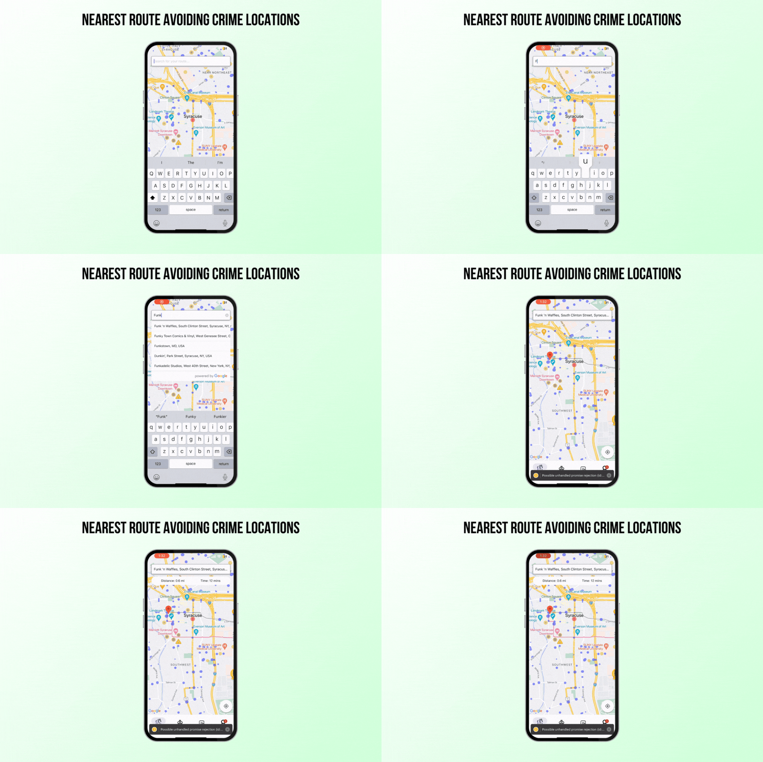
Type a destination and WalkSafe plans the walk in four steps.
Ask for the normal walk
The Flask backend asks the Google Directions API for a walking route from where you are to where you're going.
Find the hotspots on the way
It decodes the route's polyline and checks which medium-risk crime locations fall inside it, using a point-in-polygon test.
Swap them for safer stops
Each hotspot is replaced by the nearest of 20 hand-picked safer waypoints around Syracuse, capped at 25 because that's Google's waypoint limit.
Route again and compare
Google re-plans the walk through those waypoints. The app draws both lines, the fastest and the safer one, so you can choose.
Family and check-in
While the app is open, each phone sends its location to Supabase every 5 seconds, and the map refreshes family members and alerts every 10 seconds. Family members show up as avatars on the same map.
Turn on check-in and you never have to text “home safe”. Once you're within 100 metres of your saved home location, your family gets a push notification: “Hemant has reached home”.

Crime alerts
Police data only covers what has already been filed. For what's happening right now, anyone can report an incident (larceny, assault, vandalism, theft or other) at their current location. It appears on everyone's map with a warning marker and how long ago it was reported.
